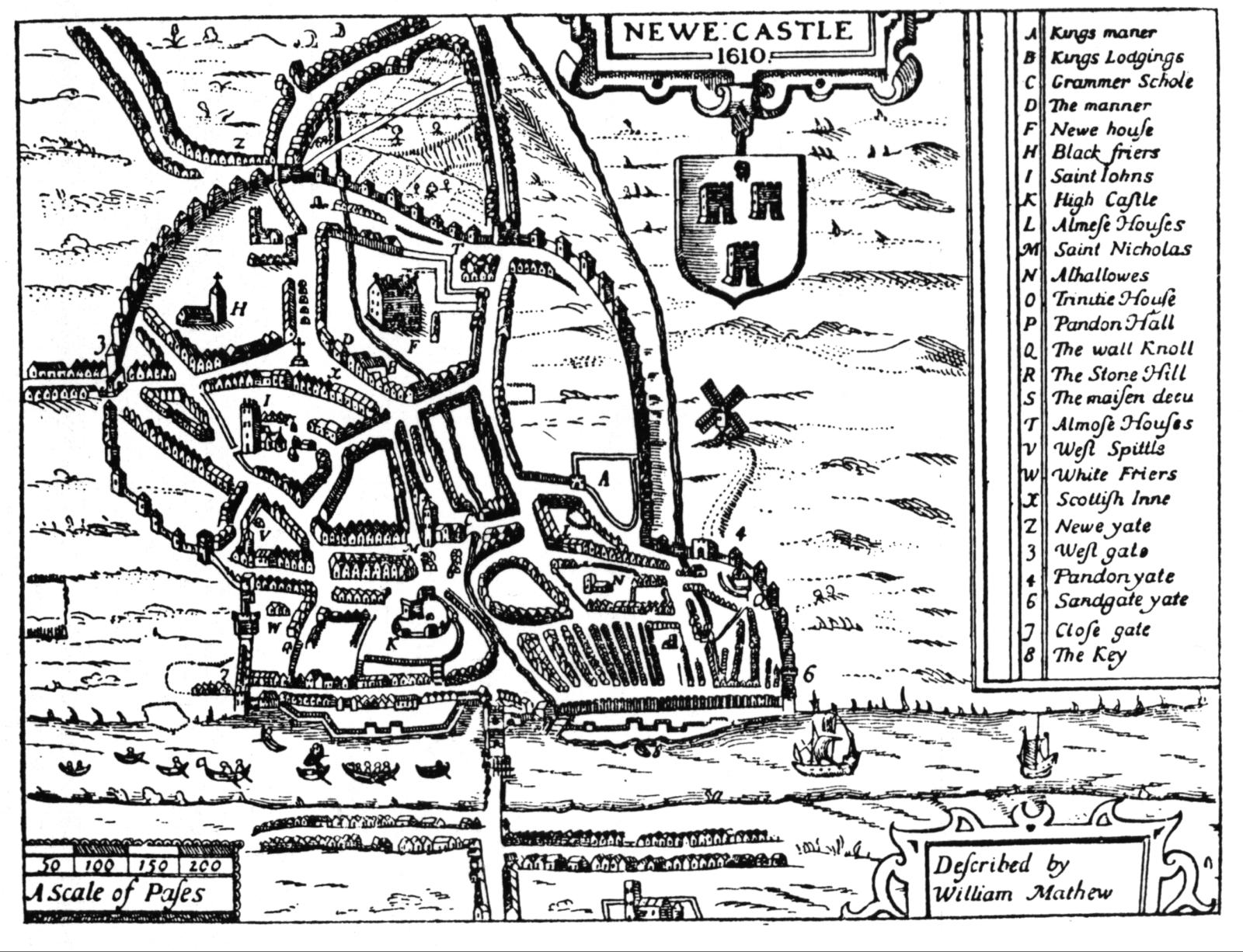
 Speed's map of Newcastle, 1610 This map originally appeared as an inset on John Speed's map of Northumberland, published in 1610 |
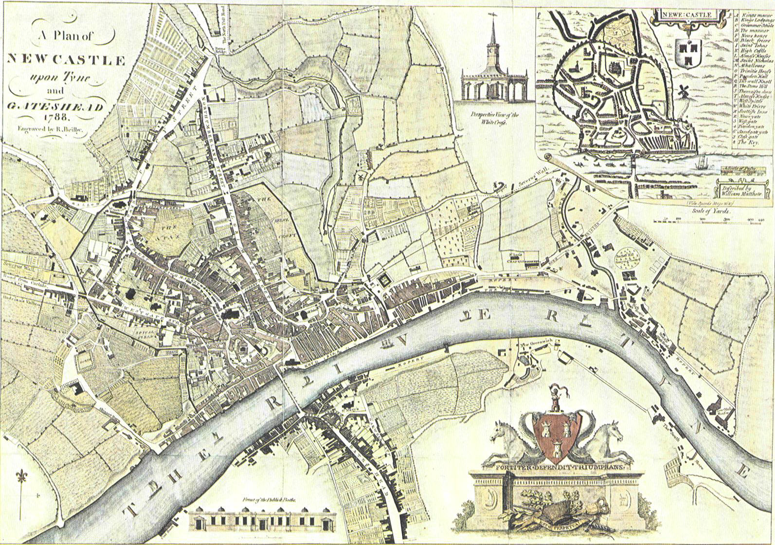 Beilby's Map Of Newcastle & Gateshead - 1788? Although clearly dated 1788, there are a number of features of this map which make me suspect it actually dates from a few years later, such as streets which weren't built until the mid 1790s. |
 Cole & Roper's Map Of Newcastle & Gateshead 1801 Cole & Roper's maps were originally published in their 'British Atlas', which appeared in various editions from 1801. The map most likely shows the area as it appeared in the late 1790s. |
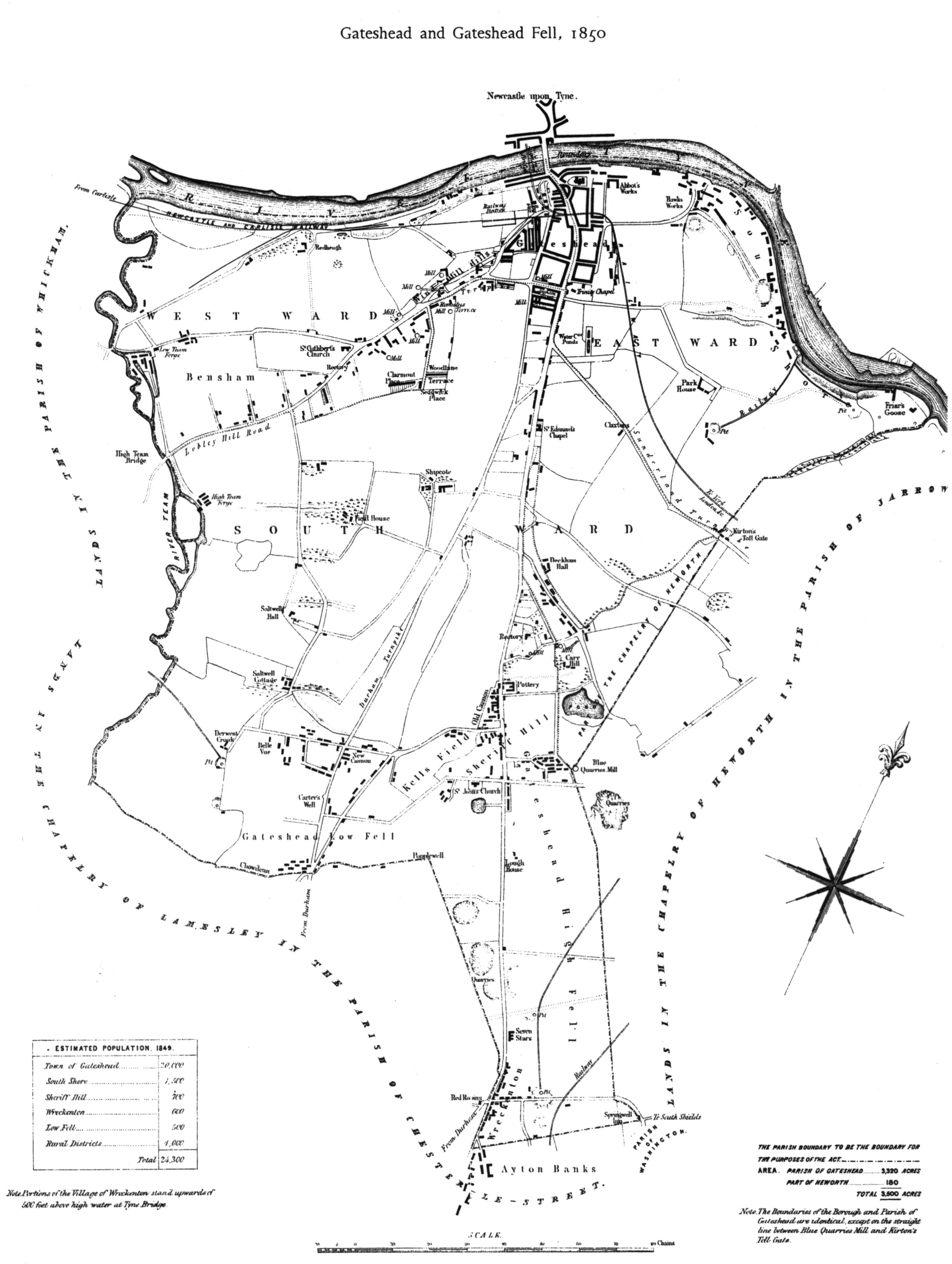 Gateshead 1850 |
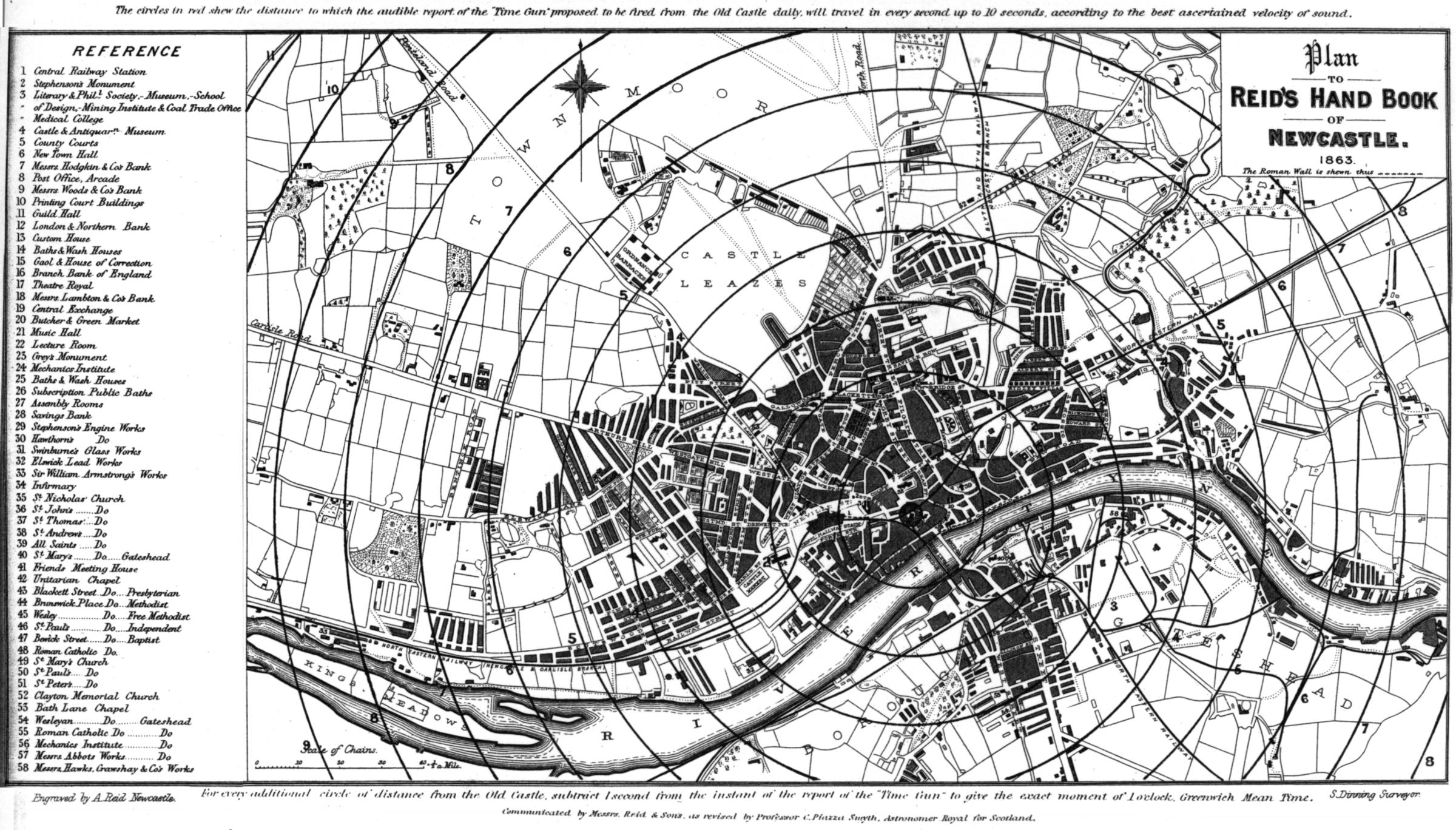 Reid's Map 1863 This map is from Reid's Handbook of Newcastle upon Tyne in 1863. The concentric circles show how long it took the sound to arrive from a cannon fired from the castle keep. |
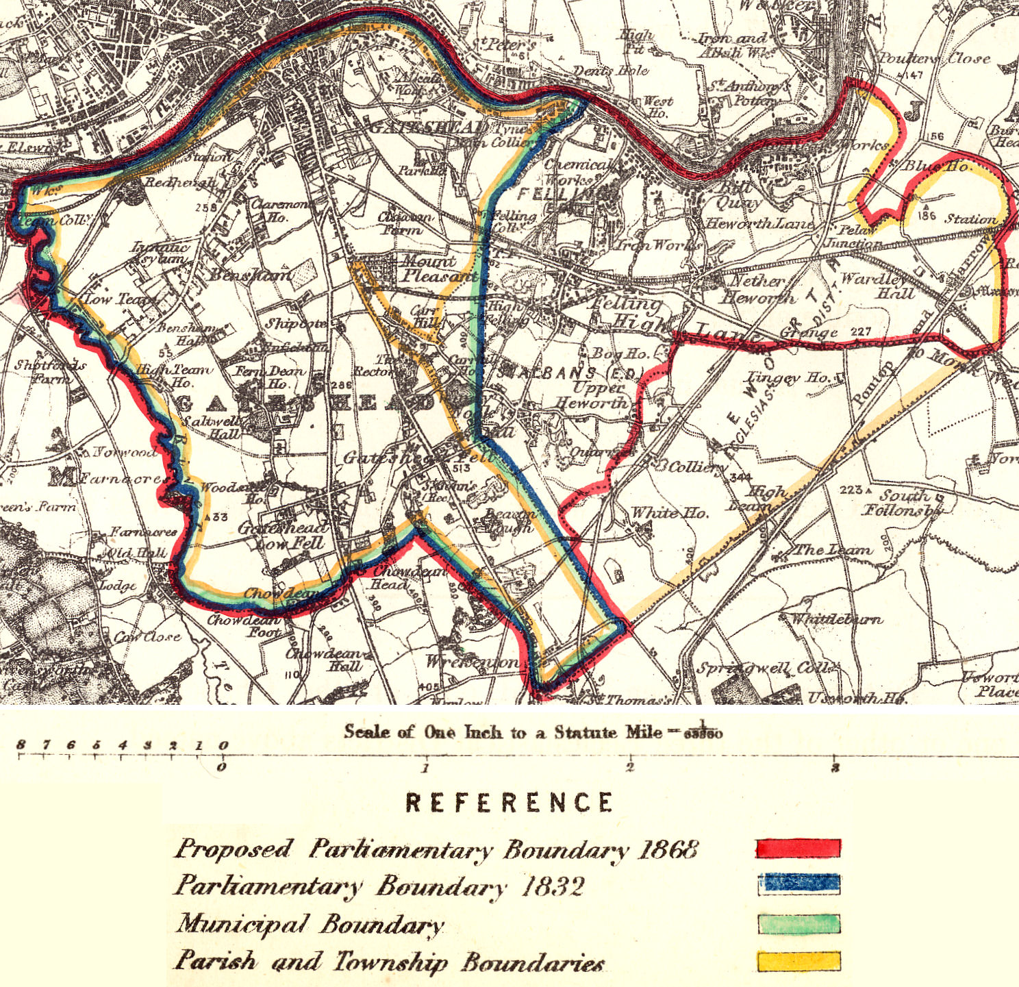 Gateshead Boundaries 1868 This map prepared by the Ordnance Survey for the Boundary Commission shows various civil and ecclesiastical boundaries (actual and proposed). |
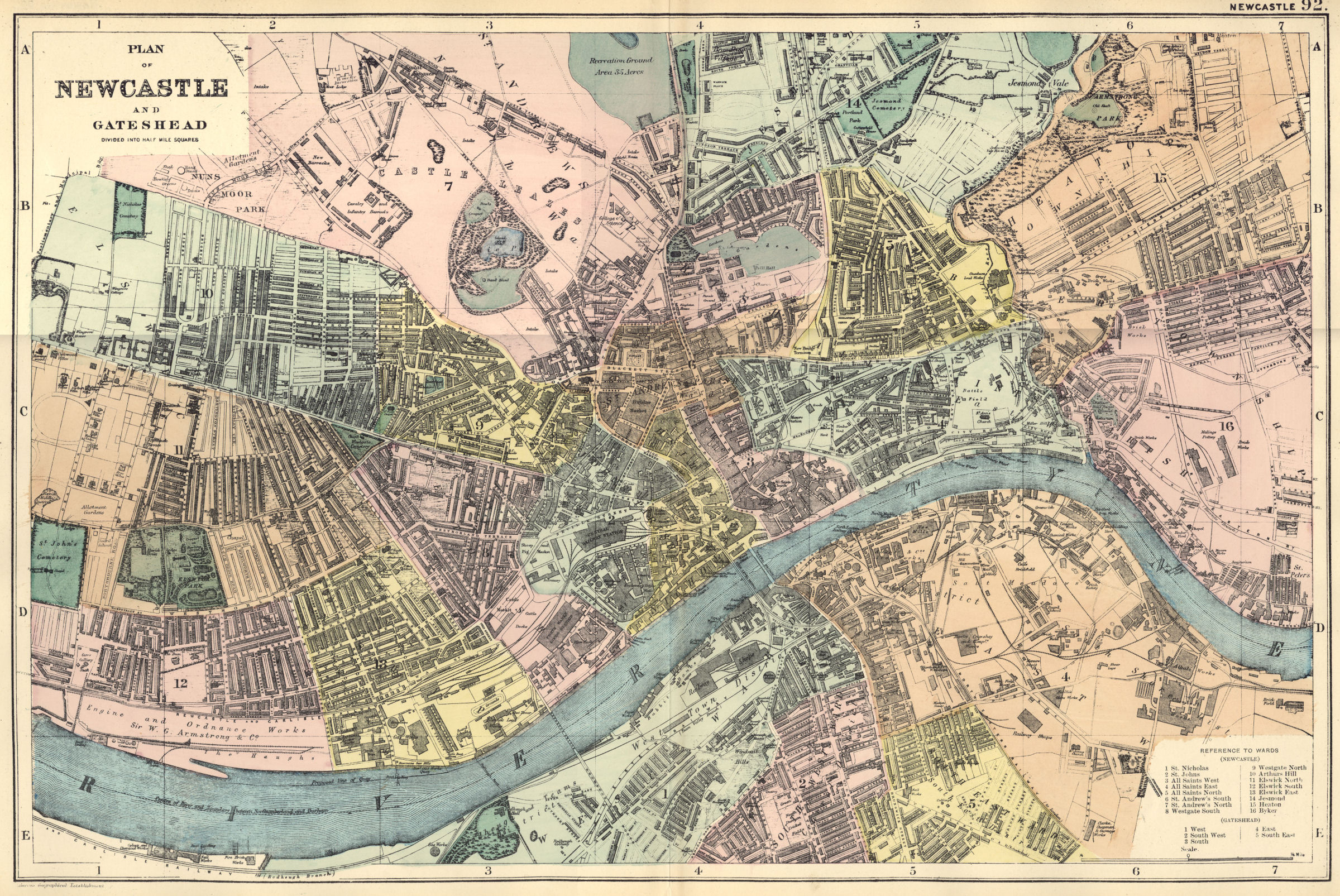 1890 Bacon Map of Newcastle & Gateshead Taken from the "New Large Scale Atlas Of The British Isles" dating from approximately 1890. If this map is insufficiently clear, for a more detailed view click the following link for a high resolution version (6.9Mb) |
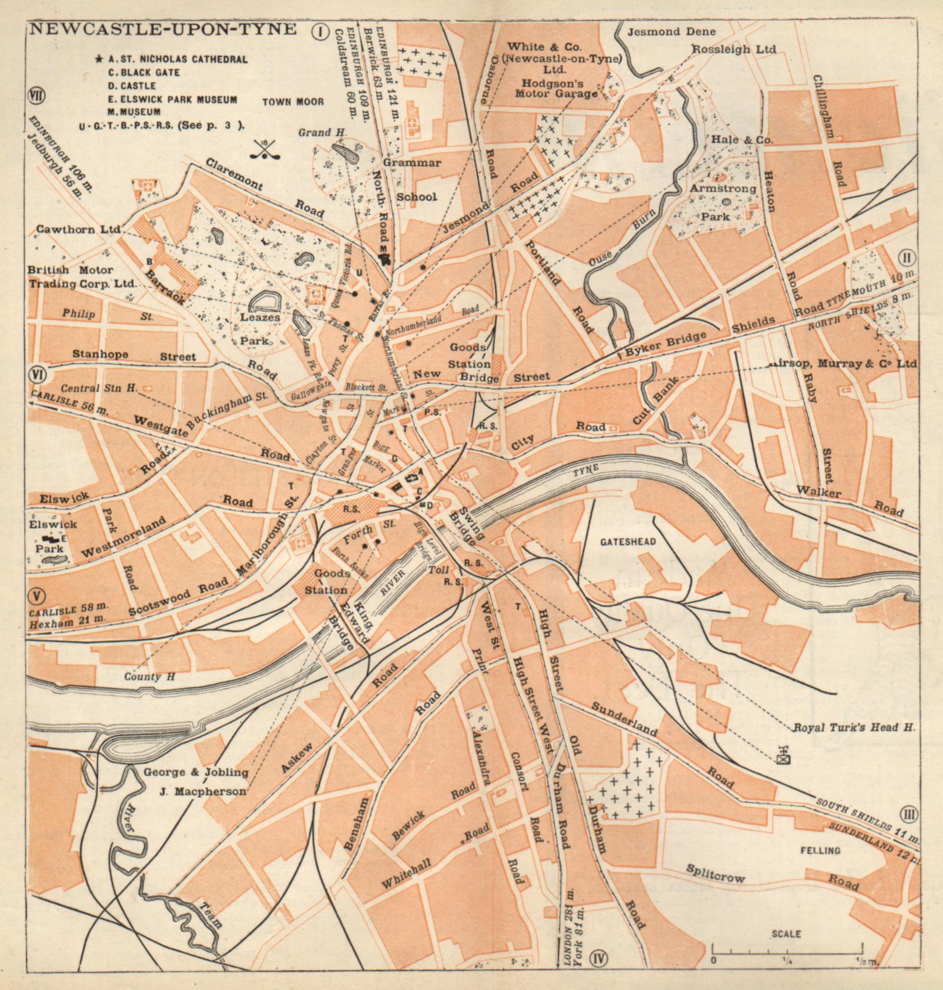 Michelin Map 1920 This map appeared in the 1920 edition of the Michelin Guide to the British Isles. The tram routes are clearly shown, and various garages are highlighted. |
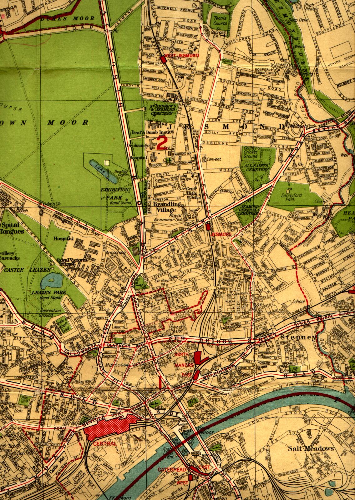 Central Newcastle c.1938 from Geographia Plan of Newcastle & Gateshead (no date on map, but the features indicate a date around 1938). Tram routes are marked in red |
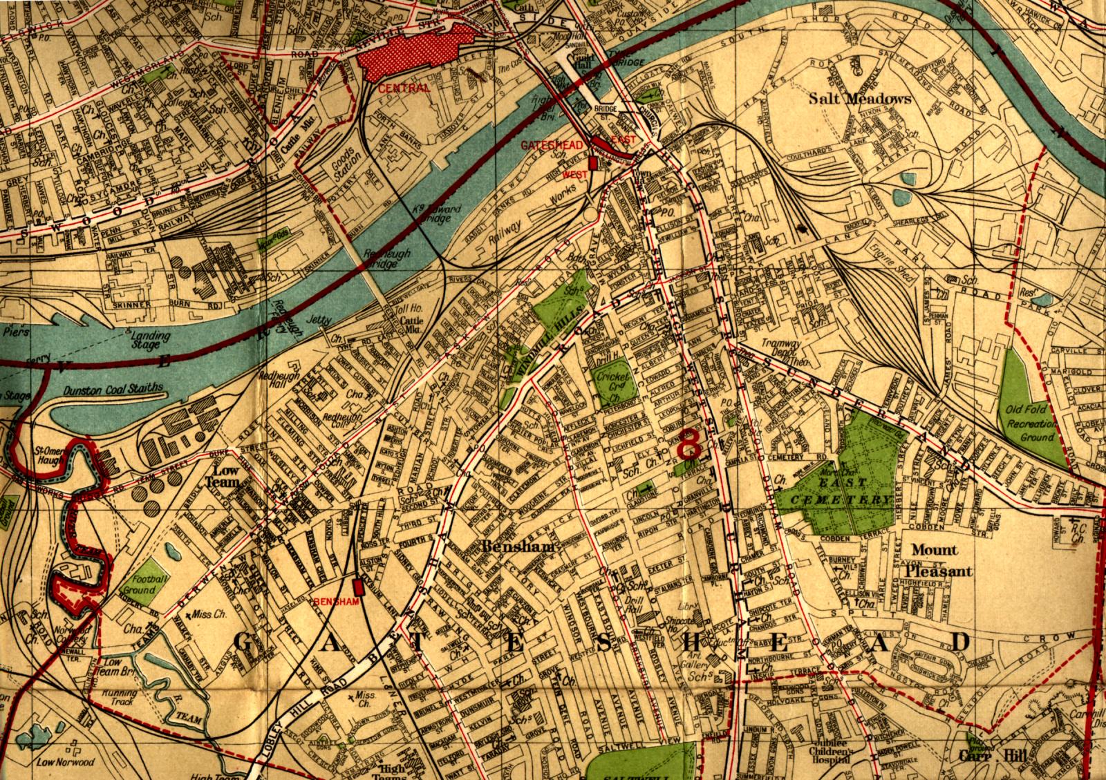 Gateshead c.1938 |